StoryMap
Timeline
Personal Essay
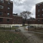
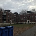
My project uses Columbia Road, the unfinished segment of the Emerald Necklace, as a relational landscape connected to the social and ecological histories of gentrification and displacement as a result of urban renewal. Urban renewal has been a complicated process in the past that has benefitted and provided for many white people but has mostly harmed minority groups that have had to be displaced as a result. Boston, particularly, has experienced a large amount of recorded displacement of African American families and replacement with higher income white families in the past which has shaped the landscape and social problems of a large part of Boston. Columbia Road runs through many areas that have been gentrified and have struggled as a result of urban renewal, so this was a major issue that is connected to the Emerald Necklace and perhaps the extension of the design of Franklin Park all the way to Joe Moakley park. Two places in particular that I had included as historical profiles are Washington Park and Madison park. I researched these projects where a run-down area of land has been converted to parks and school campuses, and the problems that the community has run into with the designers. By understanding these past issues and solutions, an improved method of urban renewal could be used in Columbia Road.
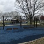
Madison Park was exemplary in terms of negotiation and persistence between the LRCC (representing the residents of lower Roxbury) and the BRA (representing the designers). Although they ran into several issues in communication during the process of the design proposal, the community that would ultimately be affected by the building of the park were able to assert their voice and be heard by the BRA. The two groups of people both wanted to have a good impact on the community and they were able to figure out how to do it in a way that was least harmful to the community and with an appropriate power dynamic. Washington Park, on the other hand, began their design proposal with a “planning with people” approach, but ultimately did not follow through on the idea because they favored speed and money. It was an example of an urban renewal plan that might be appealing to the community at first, but was ultimately executed in the wrong way. By researching this story, the communities around Columbia Park need to learn the importance of being assertive throughout the entire process. The power dynamic was shifted from the community to the BRA, which results in urban renewal that leads to a large amount of displacement.
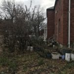
I was able to link more unrelated stories about the history of certain landmarks to Columbia Road and the communities around it. There were several places along Columbia Road that were a cultural hotspot for Dorchester and the neighboring communities, such as the Strand Theatre. This theatre had been standing since the end of World War 1, where communities would gather and celebrate, as well as going through several renovations and owners whose continuance had been dictated by the communities enthusiasm and dedication to the theatre. There are also several schools on Columbia Road, including middle schools and preschools, that shape the dynamics of the community and their movement through the landscape. They are also shaping the education and the future of the children in the surrounding communities, so they have a high social and economic importance for the area. The stories behind these landmarks are extremely important to consider in the urban renewal of Columbia Road, because a common mistake made by designers is disregarding the significance of these places to the community which leads them to have a loss of personal connection to their space. It is therefore continuously important for the people in the surrounding areas to be involved in the future projects that affect these landmarks.
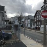
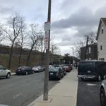
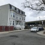
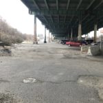
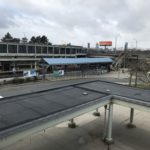
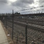
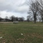
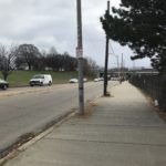
The thematic walking tour in the Story Map helps people think more deeply about the urban segregation in Boston by historic events like the Southwest Corridor proposal. When walking through Columbia Road, I was able to get a sense of the culture in the community and first hand experience of the landscape that the people are walking through on a day to day basis. It helped me, and the person going through the Story Map, to understand and relate to the people just a bit more, as well as make connections to see why certain components in the area is appreciated and held as significant. On the other hand, I was also able to get a sense of the negative affect that histories of urban segregation has had on the community. In my opinion, the highway was really a prominent landmark that shaped the atmosphere and the entire residential area around it deeply. I was able to see why people in the community had fought so hard against the building of the Southwest Corridor, and why people are reluctant to let people that built a highway in the center of the community to control the redesign of their community.
My tour resonates with several of the key readings from the semester, such as the Boston Globe and Finney's Black Faces, White Spaces. The Boston Globe had also talked about racial discrimination and segregation in a landscape due to gentrification and displacement. It mentioned that only four neighborhoods in Boston that were middle class black communities, and those needed to be preserved, like the communities surrounding Columbia Road need to be preserved and where displacement should be avoided. My tour also relates to Finny through the relationship between nature and landscape and African American families. White people taking control of their landscape and transforming it causes a strong connection between a demographic that has harmed them in the past and their own personal landscape. As a result, people of color are more reluctant to use that landscape. My research on Columbia road and gentrification in Roxbury is also related to the Southwest Corridor and the spatial segregation that it would have created, as well as the Highway that exists along Columbia Road and creates a boundary in the community.